
The storage capacity of the Great Lakes is 22,950 billion cubic metres of water, or the equivalent of over six million Olympic pools.
Introduction
From point A to point B, the water of the Fleuve Saint-Laurent (St. Lawrence River) travels approximately 250 km. Below are the stages it travels through from its departure from Lake Ontario to its arrival in Lac Saint-Louis, at the exit of the Beauharnois–Les Cèdres complex.
The Great Lakes
The Fleuve Saint-Laurent (St. Lawrence River) is part of the Great Lakes watershed, a huge freshwater reservoir whose five bodies of water contain 20% of the Earth's surface freshwater.
The combined surface area of the five lakes is 246,000 km2, about the size of the United Kingdom.


Lake Ontario
The Saint-Laurent is fed by the smallest and easternmost Great Lake, Lake Ontario, which borders the city of Toronto and separates Ontario from New York State.

From lake to river
The flow from Lake Ontario has been regulated since 1960. Hydro-Québec and its Canadian and U.S. partners thus contribute to reducing the negative impacts of spring runoff on the Saint-Laurent watershed.
Fleuve Saint-Laurent
(St. Lawrence River)
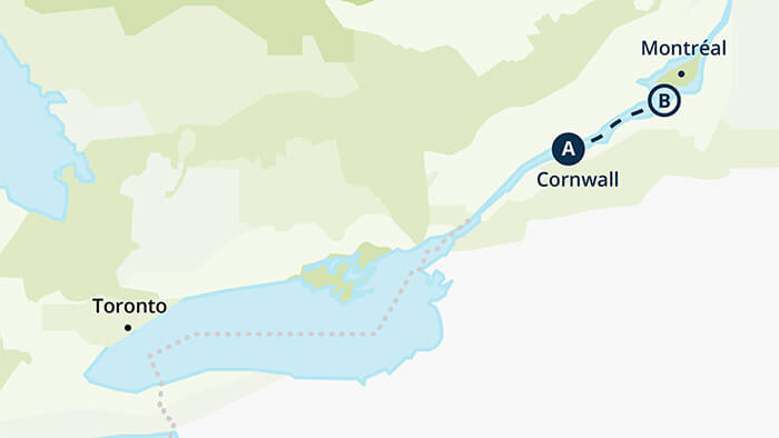
Water from Lake Ontario travels some 160 km downstream on the Saint-Laurent before crossing the first structure to regulate its flow, Moses-Saunders dam.
This dam is located between Cornwall, Ontario, and Massena, New York.


Moses-Saunders dam and St. Lawrence-Franklin D. Roosevelt Power Project and R.H.
Saunders Generating Station water flows through the turbines at the two generating stations served by the Moses-Saunders dam to generate hydropower. If the flow is greater than the capacity of the stations’ generating units, the excess water is sent through a spillway.
From Ontario to Québec
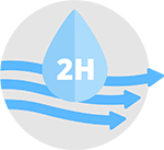
A drop of water leaving one of the Moses-Saunders generating stations takes about two hours to reach Beauharnois generating station.

Lac Saint-François
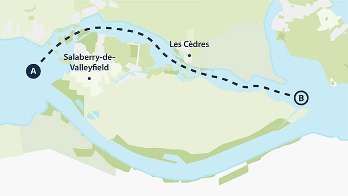
At Lac Saint-François, the water arrives at the crossroads of the Beauharnois—Les Cèdres complex, operated by Hydro-Québec. It may then take the southern route, through the Beauharnois canal, or follow the natural riverbed to the north.
Beauharnois canal and generating station
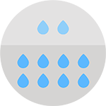
Out of every 10 drops of water, 8 will flow through the canal, maximizing hydropower production at Beauharnois generating station.

St. Lawrence Seaway
The canal is part of the St. Lawrence Seaway, and the Beauharnois navigation locks ensure that boats can circulate in both directions.
Structures on the Saint-Laurent
The water flows to the natural riverbed, passing through a cascade of structures.


Coteau dams
Once it makes it past one of the Coteau dams north of Grande-Île, the water continues its course.

Les Cèdres generating station
It may flow toward the generating units of Les Cèdres station, where it will generate hydropower, or toward Île-Juillet dams followed by Saint-Timothée basin and dam.
Other basins and dams
On its way to Lac Saint-Louis, the water first runs through the basins and dams of Pointe-du-Buisson and Pointe-des-Cascades.

Lac Saint-Louis
After reaching Lac Saint-Louis, the water continues its course along the river.
The regulation of the river’s flow, carried out by Hydro-Québec and its partners, has a key impact on the activities of the Port de Montréal.